Mid-Atlantic Ocean Data Portal Summer Update
The summer’s off to a whale of a start on the MARCO Portal. Skim below for links and news on our latest marine mammal data, maritime maps, important improvements to a Portal tool and more.
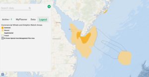
Commercial Whale & Dolphin Watch Areas: View the most popular areas for whale and dolphin watch tourism off the Mid-Atlantic coast with a new map in the Portal’s Recreation theme.
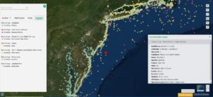
Marine Mammal Strandings: We’ve published a series of new maps charting the locations of marine mammal stranding events reported over the course of two decades from Virginia to Maine. The maps were created with data maintained by the National Oceanic and Atmospheric Administration (NOAA) Marine Mammal Health and Stranding Response Program and gathered by members of the U.S. National Marine Mammal Stranding Network.
Map Layer Import Tool Upgrades: Registered Portal users can now display a wider selection of map data types from outside websites on Marine Planner using the Map Layer Import Tool. The improved tool also now allows for imported map layers to be saved in the MyPlanner tab along with bookmarks and drawings and shared with fellow members of Portal Groups.
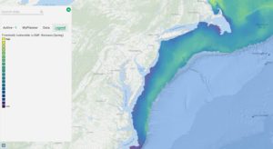
Expanded Fish Data: Animate or toggle through time series maps showing fish distributions back to 1980 and view new maps related to fish species’ potential vulnerability to electric and magnetic fields (EMF) associated with submarine power cables.
2021 AIS Vessel Transit Counts: Study annual and monthly traffic patterns from 2021 for several vessel types with a series of new maps based on Automatic Identification System (AIS) data.
Sand Resources: View areas in federal waters where sediments usable for projects such as beach nourishment, shore protection and coastal wetlands restoration may exist.
Central Atlantic Call Area: The Bureau of Ocean Energy Management published a Call for Information and Nominations in the spring to assess commercial interest in and obtain public input on potential wind energy leasing activities in federal waters of the Central Atlantic. An interactive map showing the boundaries of the Call Area, which spans from Delaware to North Carolina, is available on the Portal.
Questions or comments on these items? Let us know at portal@midatlanticocean.org.
Share this:


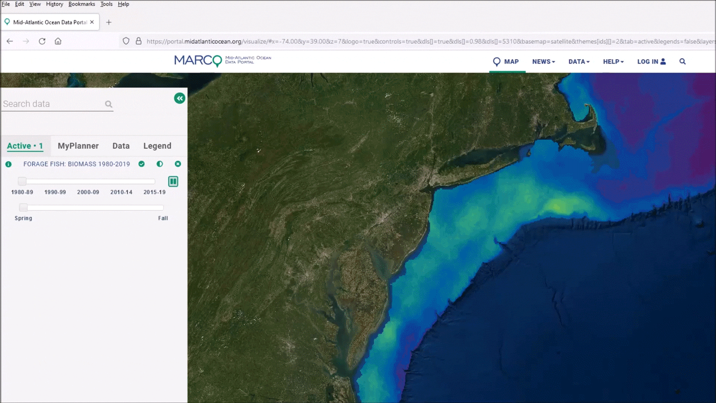
Fish istributions over time in the Mid-Atlantic