MARCO Hudson Canyon Resources
The National Oceanic and Atmospheric Administration (NOAA) is considering designating a national marine sanctuary in the Hudson Canyon area, located approximately 100 miles southeast of New York City. The Wildlife Conservation Society (WCS) submitted a nomination for a Hudson Canyon National Marine Sanctuary in 2016, noting that the area provides a wide range of benefits to New York and New Jersey residents such as recreation and food.
NOAA invited members of the public to share their views on the proposed designation through direct correspondence or at a series of virtual and in-person meetings during July and August. Although the in-person comment period has closed, the public can still provide written comments. Visit the NOAA Office of Marine Sanctuaries Hudson Canyon web page for more information on submitting comments, attending meetings, the nomination process, canyon images, and more.
To help build a better understanding of this deep-sea hotspot of biodiversity, MARCO has compiled the resources below.
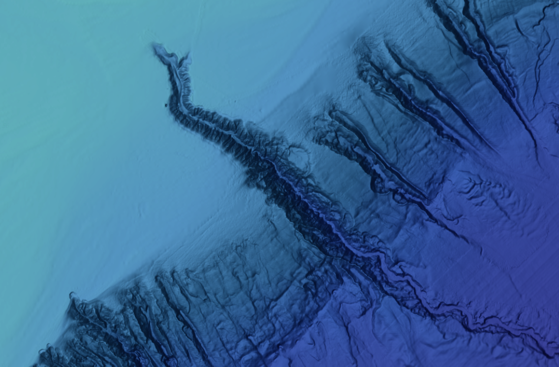
A bathymetric map from the MARCO Portal showing the Hudson Canyon and its neighbors.
Experience the Canyon with Interactive Maps
The Mid-Atlantic Ocean Data Portal contains thousands of map layers depicting seafloor habitats, marine life distributions, human uses of the ocean and more. MARCO offers the following selection of maps to learn more about the Hudson Canyon and its importance to wildlife and the economy.
- The Submarine Canyons map presents outlines of all of the region’s major canyons. Click on any canyon for a pop-up containing its name.
- The NCEI Multibeam Archive layer offers a detailed look at the Hudson Canyon’s slopes and terrain.
- The canyon is renowned as a haven for highly migratory species such as sharks, swordfish and tuna. Click any point on the map to learn which are known to roam in the area.
- Corals and sponges thrive in the jagged substrate found throughout the canyon. The Frank R. Lautenberg Deep-Sea Coral Protection Area was designated to protect them from bottom-tending fishing gear.
- This map offers an illustration of the canyon’s importance to the squid fishing industry. Note how the most intense fishing activity (dark red) almost perfectly traces the canyon’s perimeter.
- The red area centered around the Hudson Canyon’s western perimeter in this Communities at Sea map shows the area’s link to commercial fishing vessels using trawl nets from 2011-15. Click on any point to learn which ports the vessels came from.
- The canyon is also a key stop for migratory seabirds.
Questions about the Portal can be directed to portal@midatlanticocean.org.
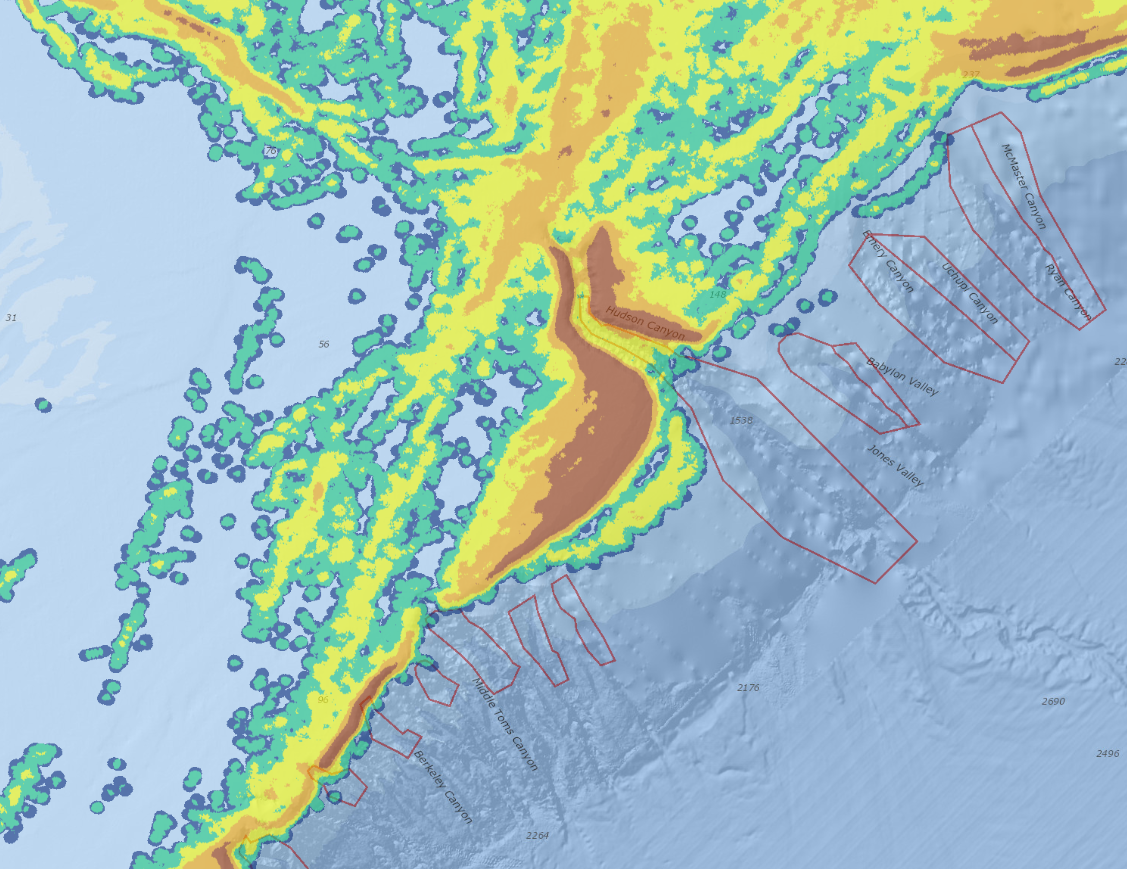
A map from the MARCO Portal showing squid fishing activity in the Hudson Canyon area.
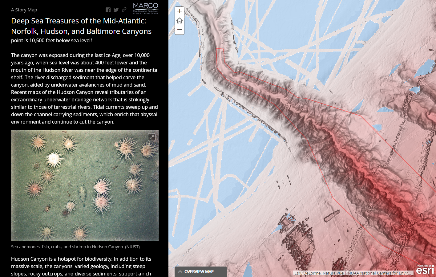
Tour the Region’s Largest Canyons with Story Map
“Deep Sea Treasures of the Mid-Atlantic: Norfolk, Hudson, and Baltimore Canyons” explores three of the largest canyons that incise the Mid-Atlantic continental shelf and slope, including information about their topography and the diversity of marine life that call them home. The story map was developed by MARCO and the Virginia Department of Environmental Quality. Readers may also be interested in this companion story map highlighting some of the region’s lesser-known canyons.
Webinars
MARCO hosted a “Life in the Deep Sea” webinar series in 2020 and 2021 that showcased the work of experts who shared photographs and information about the region’s rarely seen canyons, the unique species that live in them, and emerging threats to their health. Visit MARCO’s Marine Habitats page for a full listing of webinars.