MARCO Ocean Data Portal Has Added New Data Layers
Over 200 interactive maps depicting vessel traffic, Coast Guard study areas and regional marine sanctuaries were recently added to the Mid-Atlantic Ocean Data Portal. Take a look at what’s new below.
2018 and 2019 AIS Vessel Data: Portal users can study 2018 and 2019 traffic patterns for several types of vessels with a series of new maps based on Automatic Identification System (AIS) data. With the latest additions, the Portal now houses a total of 540 AIS maps showing vessel activity for years and months dating back to 2011. The new datasets and maps were developed in collaboration with our partners from the Marine Cadastre, U.S. Coast Guard and Northeast Ocean Data Portal team.
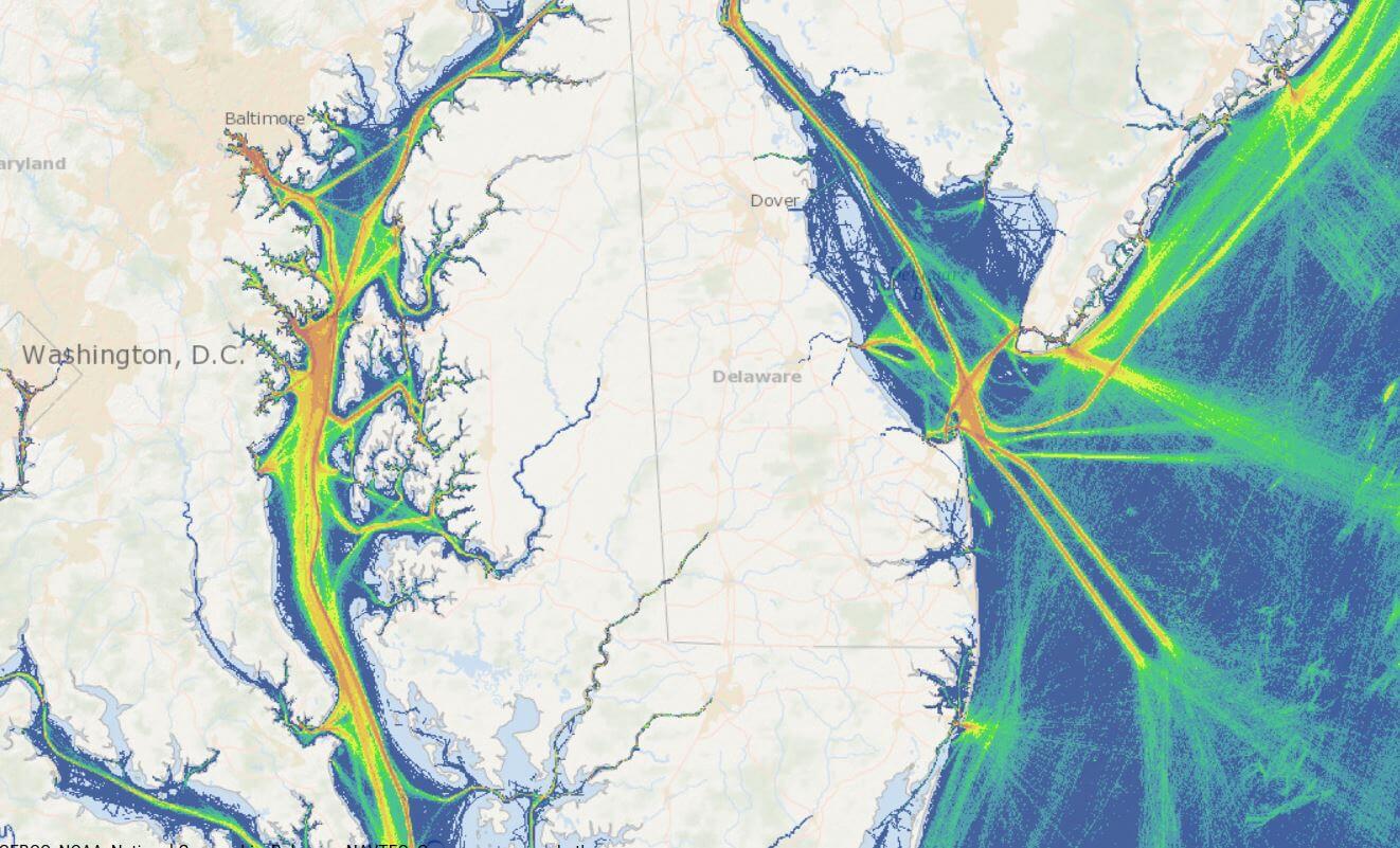
Credit: Mid-Atlantic Ocean Data Portal
Potential Fairways: This map shows a network of Atlantic Coast shipping safety fairways that are under consideration by the U.S. Coast Guard to ensure that traditional navigation routes are kept free from obstructions that could impact safety.
Port Access Route Study (PARS) Areas: The boundaries for four U.S. Coast Guard-led PARS areas along the East Coast are now presented in a single consolidated map on the Portal. In addition, this map includes the boundary for a new Northern New York Bight PARS that is currently subject to public comment.
Mid-Atlantic Marine Sanctuaries: Maps showing the areas of federal marine sanctuaries surrounding the wreck of the legendary Civil War ironclad USS Monitor off the coast of North Carolina and a fleet of sunken World War I ships in the Potomac River can now be viewed in Marine Planner. The Monitor and Mallows Bay-Potomac sanctuaries maps can be found in Marine Planner’s Administrative theme.
Carl N. Schuster Jr. Horseshoe Crab Reserve: At the request of commercial fishing industry stakeholders, we’ve added a map showing this area, located off the coasts of Southern New Jersey and Delaware, to the Portal’s Fishing Management Areas collection. Data for the layer was provided by the National Marine Fisheries Service Greater Atlantic Regional Fishery Office.
Deep-Sea Corals and Sponges: The Portal’s map showing NOAA data for the locations of observed corals and sponges has been replaced with a new version that includes additional species and many new points throughout the region.
Share this:


Credit: Duke University Marine Robotics and Remote Sensing