MARCO Portal Adds New Themes, N.Y. Bight Wind and Maritime Data
Mid-Atlantic Ocean Data Portal users can now find two new data themes and maps illustrating offshore wind energy and anchorage areas under examination in the New York Bight. Learn more about these and other recent Portal updates with the links below.
NY Bight Wind Energy Areas: The Portal’s Bureau of Ocean Energy Management (BOEM) Wind Planning Areas map has been updated to include nearly 800,000 acres of newly designated Wind Energy Areas (WEA) between Long Island and the New Jersey coast. In addition, three older Portal maps that depicted previous steps in the WEA identification process have been retired.
Ambrose Anchorage Ground: A 15-square mile anchorage area proposed by the U.S. Coast Guard to accommodate future vessel traffic to port facilities in New York and New Jersey has been added to the Maritime theme. The area is located in the approaches to New York, approximately 3 nautical miles south of Long Beach, New York, and just north of the Nantucket to Ambrose Traffic Lane.
Seafloor Habitat Theme & Modeled Shoals: A new theme has been created to house and provide more direct access to the Portal’s collection of Seafloor Habitat maps, which is set to expand significantly in 2021. Among the first additions is a Modeled Shoals in Federal Waters map, developed by BOEM and the National Oceanic and Atmospheric Administration, showing the predicted locations of sandbanks off the Mid-Atlantic coast.
Water Quality Theme & Impaired Waters Map: The Portal’s growing collection of maps depicting water pollution and changes in ocean chemistry are now organized in a new Water Quality theme. Among the data available is a newly added map that provides users a snapshot of the overall health of thousands of waterways in the region and links to Environmental Protection Agency reports on their suitability for a range of uses.
If you have questions about these or any other features on the Portal, please contact the Portal team at portal@midatlanticocean.org.
Share this:


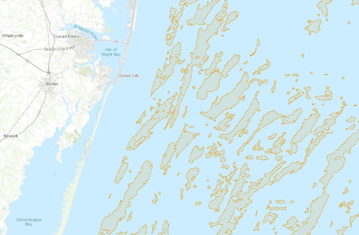
Modeled shoals in federal waters map